

BBB A+ Accredited Business
Description
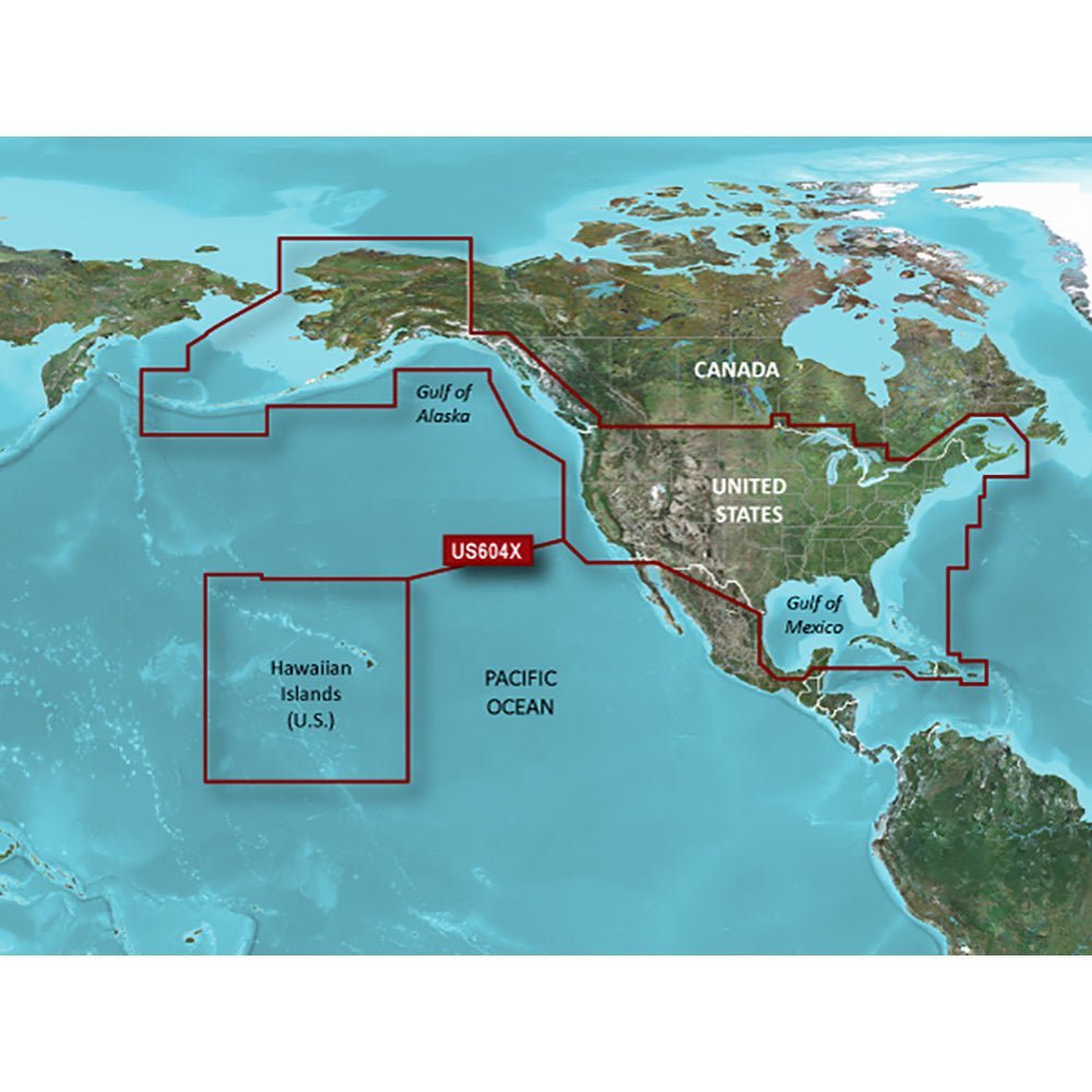
 Garmin BlueChart® g3 HD HXUS604x on microSD/SD provides unparalleled coastal coverage for US All & Canadian West, delivering industry-leading detail and clarity to support confident navigation along seas, bays, and channels you rely on. This portable chart set covers extensive U.S., Alaska, Hawaii, Canadian waters, major inland rivers, Gulf Coasts, Mexican Gulf Coast to the Yucatan, and Bahamas/Caribbean regions, helping mariners plan and execute precise routes.
- Coverage Extent: Detailed U.S. coastal coverage (East Coast from Key West, FL to the Canadian border; West Coast from Puget Sound to the Mexican border), Alaska, Hawaii, major inland rivers, Gulf Coasts, Mexican Gulf Coast to the Yucatan, and comprehensive Canadian coverage including the St. Lawrence Seaway, Great Lakes, Prince Edward Island, Vancouver Island, and Inside/Outside Passages; extended areas in the Bahamas and Caribbean region.
- Auto Guidance: Smart navigation that calculates a recommended route based on your desired depth and overhead clearance, overlaid on your chart for easy following.
- Depth Range Shading: Visualizes up to 10 depth ranges so you can quickly identify target depths at a glance.
- Contours & Bottom Detail: Detailed contours with up to 1’ contour lines for accurate representation of bottom structure—beneficial for fishing, swamps, canals, and marinas.
- Shallow Water Shading: Highlights shallow areas to help you navigate safely in busy coastal waters.
- NOAA Raster Cartography: Paper-chartlike views via the ActiveCaptain® app, labeling points of interest with longitude and latitude for easier planning.
- Data Integration: Integrated Garmin and Navionics data for superior chart clarity and coverage.
- Format & Availability: Fully portable on microSD/SD; worldwide coverage available by region as accessory cards or via download, with each region sold separately.
- Target Audience: Designed for serious mariners who demand precise coastal intelligence and versatile mapping on a portable microSD/SD card.
With this chart, you gain confidence navigating along coastlines, bays, and channels you rely on. The extensive regional coverage supports efficient route planning, depth awareness, and easy access to points of interest as you explore new regions or refine your favorite routes.
Payment & Security
Your payment information is processed securely. We do not store credit card details nor have access to your credit card information.