

BBB A+ Accredited Business
Description
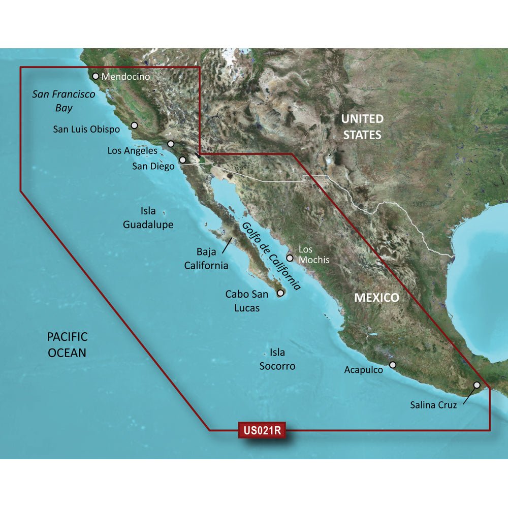
Garmin BlueChart g3 Vision HD — VUS021R provides ultra-detailed coastal navigation coverage along the California–Mexico coast for Garmin chartplotters and handheld devices, combining advanced chart data with immersive visuals for confident planning and routing.
- Coverage Area: Comprehensive coastal charts from Point Arena to Puerto Vallarta, including Mendocino, San Francisco Bay, Channel Islands, San Diego, the Baja Peninsula, and broader Mexican coast regions such as Mazatlan, Acapulco, and Salina Cruz.
- Charting Technology: Industry-leading BlueChart g3 Vision data integrated with Navionics for enhanced clarity, depth information, and diverse routing options.
- Auto Guidance: Uses your desired depth and overhead clearance to calculate routes and provide a suggested path to follow.
- Relief Shading: High-resolution relief shading with color and shadow to reveal bottom structure beyond standard contour lines.
- Depth Range Shading: Supports up to 10 depth ranges, with contours as precise as 1' for accurate bottom depiction.
- NOAA Raster Cartography via ActiveCaptain: Optional NOAA-style raster charts viewable on compatible devices through the ActiveCaptain app (free download).
- Shallow Water Shading: Highlights shallow zones to help you steer clear of hazards.
- Satellite Imagery: High-resolution port, marina, bridge, and landmark imagery for improved situational awareness.
- 3-D Views: MarinerEye and FishEye perspectives offer above- and below-water views for enhanced visualization.
- Compatibility: Designed for microSD/SD cards to fit Garmin chartplotters and handheld devices.
- Prop 65 Warning: This product includes a California Prop 65 warning due to potential chemicals; for more information visit P65Warnings.ca.gov.
Navigate with confidence using precise depth cues, advanced charting, and immersive visuals that help you plan routes, avoid shallow areas, and recognize key landmarks before you arrive. The combination of BlueChart g3 Vision and Navionics data delivers reliable coastal coverage from the California coast through Baja and into Mexican waters, with flexible microSD/SD compatibility that fits your Garmin device ecosystem.

Payment & Security
Your payment information is processed securely. We do not store credit card details nor have access to your credit card information.