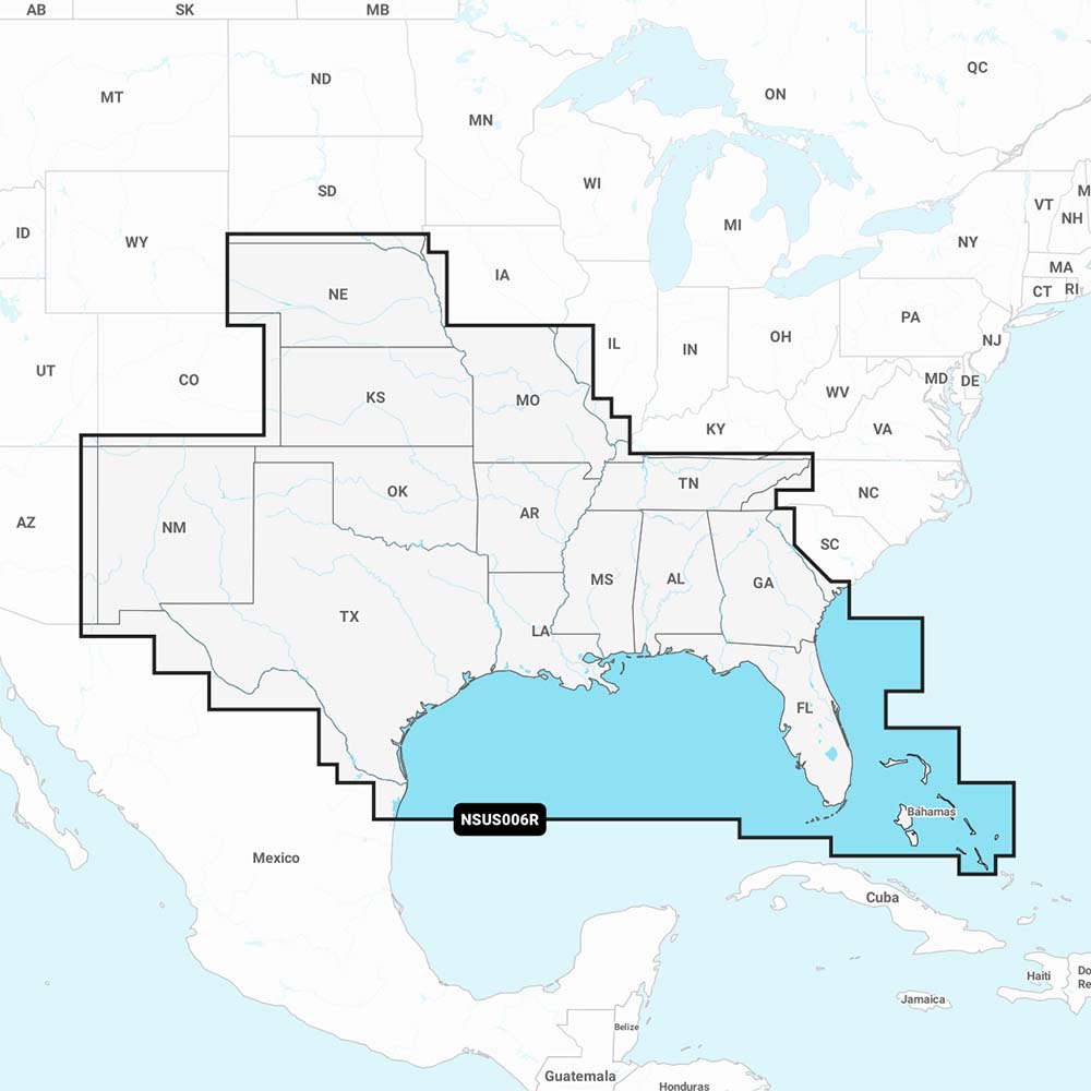
Garmin Navionics+ NSUS006R U.S. South is an all-in-one marine mapping solution designed for compatible Garmin chartplotters. It blends Navionics+ charts with Garmin data to deliver detailed coastal, lake, and river mapping along with enhanced fishing insights.
-
Navionics+ cartography: Fresh Navionics+ data for the U.S. South loaded to your compatible chartplotter, covering coastal waters, lakes, and rivers.
-
Ultra-detailed SonarChart HD: 1’ (0.5 m) contour bathymetry for precise bottom structure and prime fishing spots.
-
Dock-to-dock route planning: Plan routes through channels, inlets, marina entrances, and more. Route guidance is for planning purposes only and does not replace safe navigation operations.
-
Plotter Sync: Wireless access to daily chart updates via the Navionics Boating app (subscription required for the area).
-
Navionics Chart Installer: Ensures you have the freshest chart data every time you go out.
-
Community Edits: Local insights contributed by Navionics Boating app users on your chartplotter.
-
SonarChart Live: Create real-time 1’ HD bathymetry maps while you navigate.
-
Shallow water shading: Depth shading up to a user-defined level to aid navigation and fishing.
-
Worldwide coverage on microSD: Global charts available on microSD cards, with updates via an annual renewable subscription (first year of updates included).
-
Broad Garmin compatibility: Works with a wide range of Garmin chartplotters including Echomap UHD (7/9), Echomap Ultra (10/12), GPSmap 10X2/12X2, GPSmap 12X2 Touch, GPSmap 7X2/9X2/12X2 Plus, GPSmap 7X3/9X3/12X3, GPSmap 8400/8600, GPSmap 8700 Black Box, and more.
-
Designed for clear coverage and ease of use: Navionics+ NSUS006R combines Garmin and Navionics content for detailed, familiar navigation control.
-
Daily updates and personalization: Access updates via Plotter Sync or the Navionics Boating app, and personalize maps with SonarChart Live and Community Edits.
With Navionics+ on your Garmin device, you gain up-to-date charts, planning tools, and real-time depth data to improve navigation, fishing decisions, and voyage planning. The blend of daily updates, community-sourced insights, and live bathymetry helps you navigate confidently, discover productive fishing spots, and reduce guesswork in unfamiliar waters.