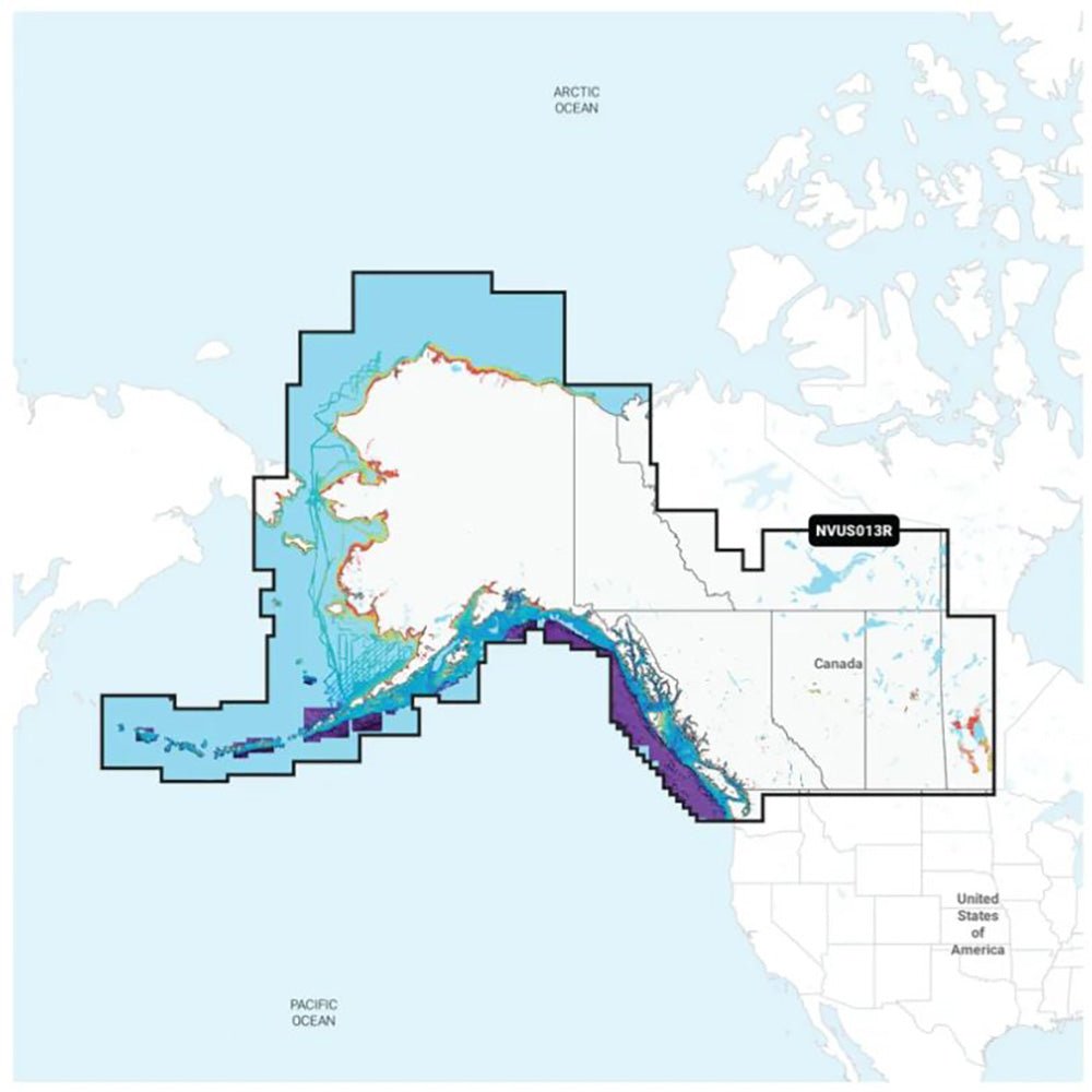
Garmin Navionics Vision+ NVUS013R Canada, West & Alaska is an all-in-one marine map solution for Garmin chartplotters, blending Navionics precision with Garmin routing. It covers western Canada and Alaska—from Vancouver Island and Puget Sound to the Aleutian Islands—delivering vibrant visuals, a streamlined interface, and familiar Navionics colors for quick plotting.
-
All-In-One Map Solution: Detail-rich coastal features, lakes, rivers, and more, with integrated Garmin and Navionics content offering broad, reliable coverage for boaters.
-
Daily Chart Updates: Charts are continually enhanced, with up to 5,000 updates daily. The included one-year subscription provides access to daily updates via the ActiveCaptain app.
-
Auto Guidance+ Technology: Combines Garmin and Navionics automatic routing to deliver a dock-to-dock path through channels, inlets, and marina entrances.
-
Depth Range Shading & Contours: High-resolution depth shading lets you choose up to 10 color-shaded target depths, plus up to 1' contours for precise bottom detail.
-
Shallow Water Shading: User-defined depth shading to clearly identify shallow areas and avoid hazards.
-
ActiveCaptain Community: Community-sourced POIs, marinas, anchorages, hazards, businesses, and more, with real-world recommendations from fellow boaters.
-
Premium Vision+ Features: High-Resolution Relief Shading, High-Resolution Satellite Imagery, and Aerial Photography for richer situational awareness. The 3D Fisheye View adds an underwater perspective for navigation insight.
-
Format & Coverage: Available in microSD/SD format, covering western Canada and Alaska, including Vancouver Island, Puget Sound, and the Aleutian Islands.
With Navionics Vision+ on your Garmin chartplotter, you gain a trusted marine mapping ecosystem that merges topography, bathymetry, and real-world updates in one place. The Auto Guidance+ routing helps plan safer, more efficient trips while up-to-date chart data reveals prime fishing spots and navigational features at a glance. Depth shading, 1' contours, and shallow-water shading provide precise bottom detail and hazard awareness, complemented by Premium imagery and the 3D Fisheye View for enhanced navigation insight. Includes a one-year subscription that provides daily chart updates via the ActiveCaptain app.