

BBB A+ Accredited Business
Description
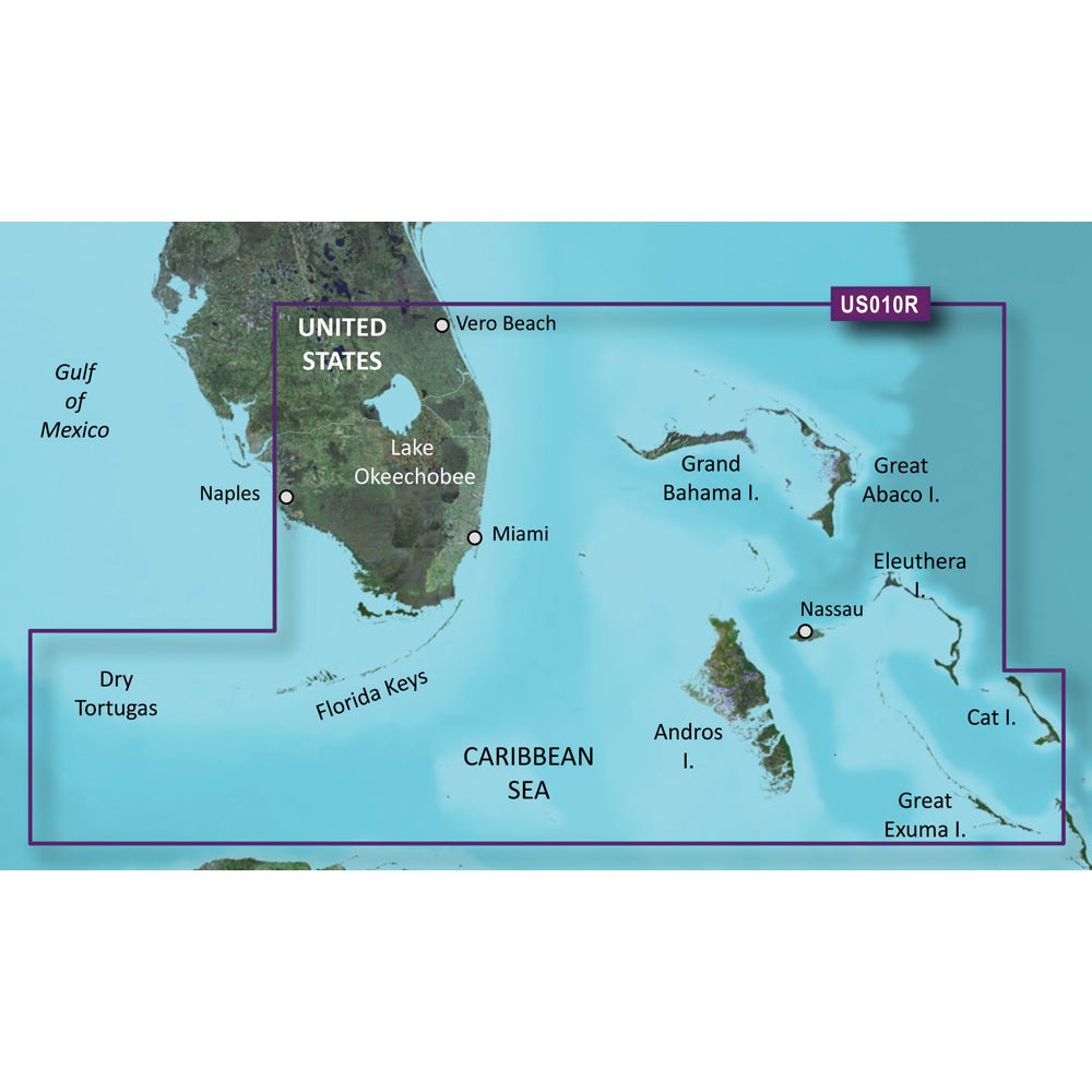
Garmin BlueChart g3 Vision HD — VUS010R for microSD/SD delivers premier coastal navigation coverage for Southeast Florida and the Bahamas. It’s designed for boaters who rely on precise charts for planning, fishing, and coastal exploration.
- Coverage: Southeast Florida (Vero Beach to Naples) and the Bahamas, including Lake Okeechobee, the Florida Keys, Dry Tortugas, the Florida west coast, plus Andros, Eleuthera, Cat Island, Great Exuma, Little Exuma, and Hog Cay.
- Integrated chart data: Premier coastal charts with integrated Garmin and Navionics data for clear shoreline, depths, and aids to navigation.
- Auto Guidance: Planning tool that uses your desired depth and overhead clearance to calculate a route and a suggested path to follow.
- Relief shading: High-resolution relief shading combines color and shadow to present bottom structure at a glance.
- Depth Range Shading: Up to 10 depth ranges to quickly view your target depth.
- Contour detail: Up to 1’ contours for precise depictions of bottom features, aiding fishing, swamps, canals, and marina navigation.
- NOAA raster cartography: Option available via the ActiveCaptain app for a paper-chart look (where compatible).
- Shallow Water Shading: Highlights safe depths to help avoid shallow areas and hazards near the coast.
- 3-D views: MarinerEye and FishEye perspectives provide above- and below-water views for added situational awareness.
- High-resolution imagery: Satellite imagery of ports, marinas, bridges, and landmarks for easier recognition and planning.
- Compatibility: Designed for high-detail coastal navigation on compatible Garmin devices; feature availability may depend on platform (ActiveCaptain compatibility, etc.).
With these features, the chart set supports confident planning, precise routes, and enhanced awareness for coastal navigation and fishing across Southeast Florida and the Bahamas.

Payment & Security
Your payment information is processed securely. We do not store credit card details nor have access to your credit card information.