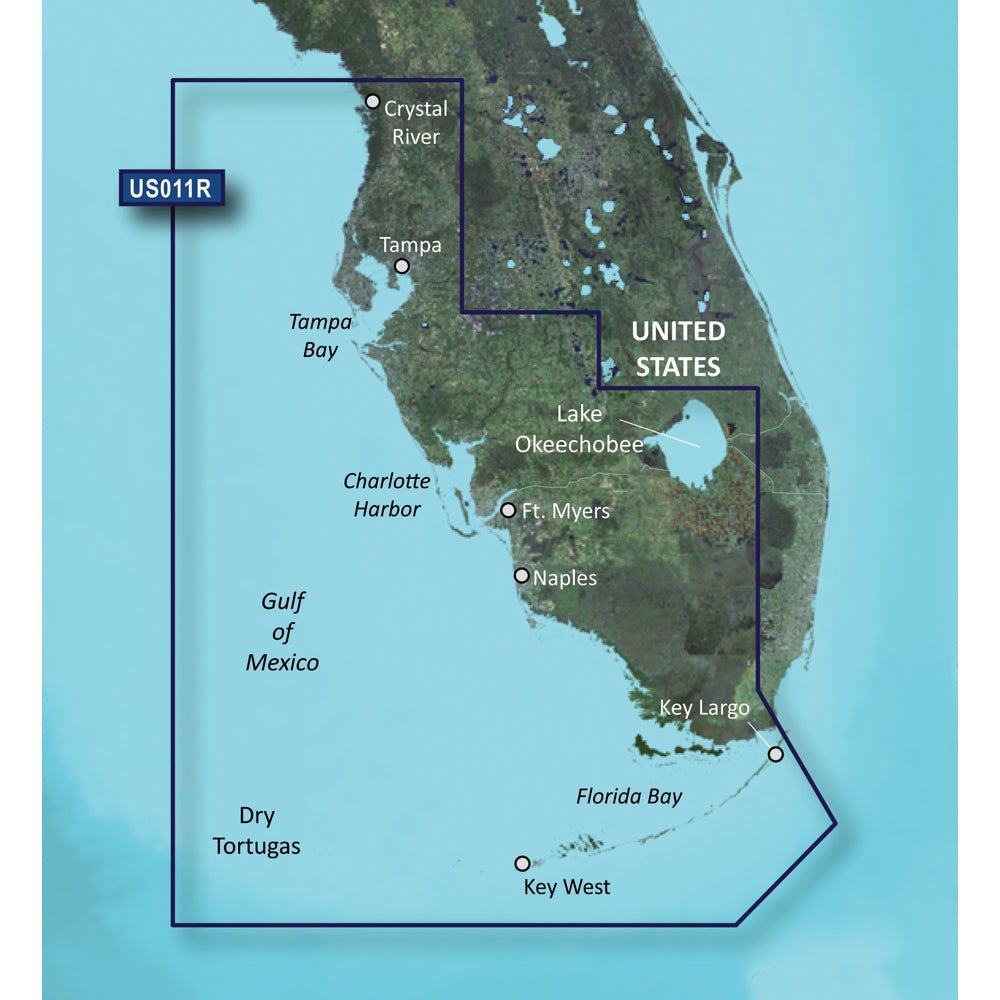
Garmin BlueChart g3 Vision HD - VUS011R for Southwest Florida, on microSD/SD, provides detailed coastal charts from Crystal River through Key Largo. It combines Garmin and Navionics data with advanced planning tools to enhance navigation, trip planning, and fishing insights.
-
Region Coverage: Southwest Florida coast from Crystal River to Key Largo, including Tampa Bay, Ft. Myers, Lake Okeechobee, Florida Bay, Key West, and the Dry Tortugas.
-
Integrated Data: Combines Garmin and Navionics data for the most complete coastal charts.
-
Auto Guidance: Uses your desired depth and overhead clearance to calculate a recommended route.
-
Relief Shading: High-resolution relief shading reveals bottom structure with color and shadow beyond traditional contours.
-
Contours: Up to 1' contours provide precise depiction of underwater features for fishing, swamps, canals, and marinas.
-
Depth Range Shading: Supports up to 10 depth ranges for quick depth awareness at a glance.
-
Shallow Water Shading: Highlights shallow zones to help you avoid hazards.
-
NOAA Raster Cartography: Available via the ActiveCaptain app for classic paper-chart visuals (note: not viewable on echoMAP CHIRP and ECHOMAP Plus combos).
-
Satellite Imagery: High-resolution imagery provides detailed views of ports, marinas, bridges, and landmarks for superior situational awareness.
-
3-D Views: MarinerEye and FishEye perspectives above and below the water line enhance situational awareness.
-
Chart Card Type: microSD/SD chart card for easy on-device installation and use.
-
Regulatory Notice: California Prop 65 warning applies to this product.
-
Return Policy Note: May not be returned to the original point of purchase; contact the manufacturer for issues or concerns.
With BlueChart g3 Vision HD, you gain dependable coastal coverage that supports confident navigation through busy channels and intricate waterways. Auto Guidance helps plan safe routes around depth restrictions and overhead clearances, while high-resolution relief shading and up to 1' contour data reveal bottom structures for precise fishing and marina navigation. Depth Range Shading and Shallow Water Shading offer quick, at-a-glance awareness to help you avoid hazards. NOAA Raster Cartography via the ActiveCaptain app provides familiar visuals for traditionalists, and high-resolution satellite imagery adds context for ports, bridges, and landmarks. The 3-D views, MarinerEye and FishEye, enhance situational awareness by offering perspectives above and below the water line.