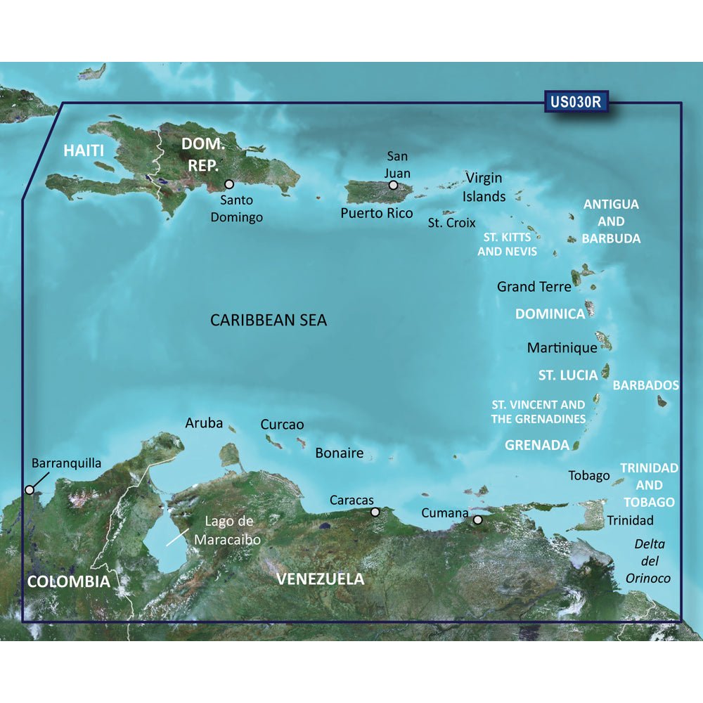
Garmin BlueChart g3 Vision HD — VUS030R provides ultra-detailed coastal charts for Southeast Caribbean navigation and fishing, packaged in microSD/SD format for use with compatible Garmin devices. It covers Haiti to Trinidad & Tobago, Puerto Rico and the Lesser Antilles, plus the Colombian and Venezuelan coasts from Barranquilla to the Orinoco River mouth, Lake Maracaibo, and the Gulf of Paria.
-
Coverage area: Southeast Caribbean — Haiti to Trinidad & Tobago, Puerto Rico and the Lesser Antilles, plus the Colombian and Venezuelan coasts from Barranquilla to the Orinoco River mouth, Lake Maracaibo, and the Gulf of Paria
-
Format: microSD/SD chart data for use with compatible Garmin devices
-
Integrated data: Garmin and Navionics data combined for comprehensive, up-to-date chart information
-
Auto Guidance: Depth- and overhead clearance-based routing to a recommended course for planning
-
Relief shading: High-resolution color shading that reveals bottom structure beyond contour lines
-
Depth range shading: Up to 10 depth ranges to view target depths at a glance
-
Contours: Up to 1’ contours for precise depiction of bottom features, aiding navigation in channels, swamps, and marinas
-
NOAA Raster Cartography: Free download via the ActiveCaptain app, offering a traditional chart look on modern displays
-
Shallow water shading: Depth and Shallow Water Shading highlight shallow zones to help avoid hazards
-
Satellite imagery: High-resolution visuals of ports, marinas, bridges, and navigational landmarks
-
3-D Views: MarinerEye and FishEye perspectives for enhanced views above and below the waterline
-
Compatibility note: Raster cartography may not be viewable on all device combos; Auto Guidance is for planning purposes only
-
Prop 65 warning: This product can expose you to chemicals known to the State of California to cause cancer, birth defects, or other reproductive harm
With industry-leading coverage and clarity, Garmin BlueChart g3 Vision HD VUS030R merges Garmin and Navionics data for a seamless navigation experience. Auto Guidance assists in plotting routes based on your preferred depth and overhead clearance, while high-resolution relief shading and up to 10 depth-range shading provide quick insight into bottom structure and target depths. Contours as fine as 1 foot offer precise depictions of channels, marinas, and shallow areas. NOAA Raster Cartography via the ActiveCaptain app delivers a traditional chart aesthetic on modern displays, and high-resolution satellite imagery enhances situational awareness of ports and landmarks. The 3-D views, MarinerEye and FishEye, add depth to planning both above and below the water. Note that raster cartography may not be viewable on all device combinations, and Auto Guidance is for planning purposes only—always navigate with active observation and safe practices.