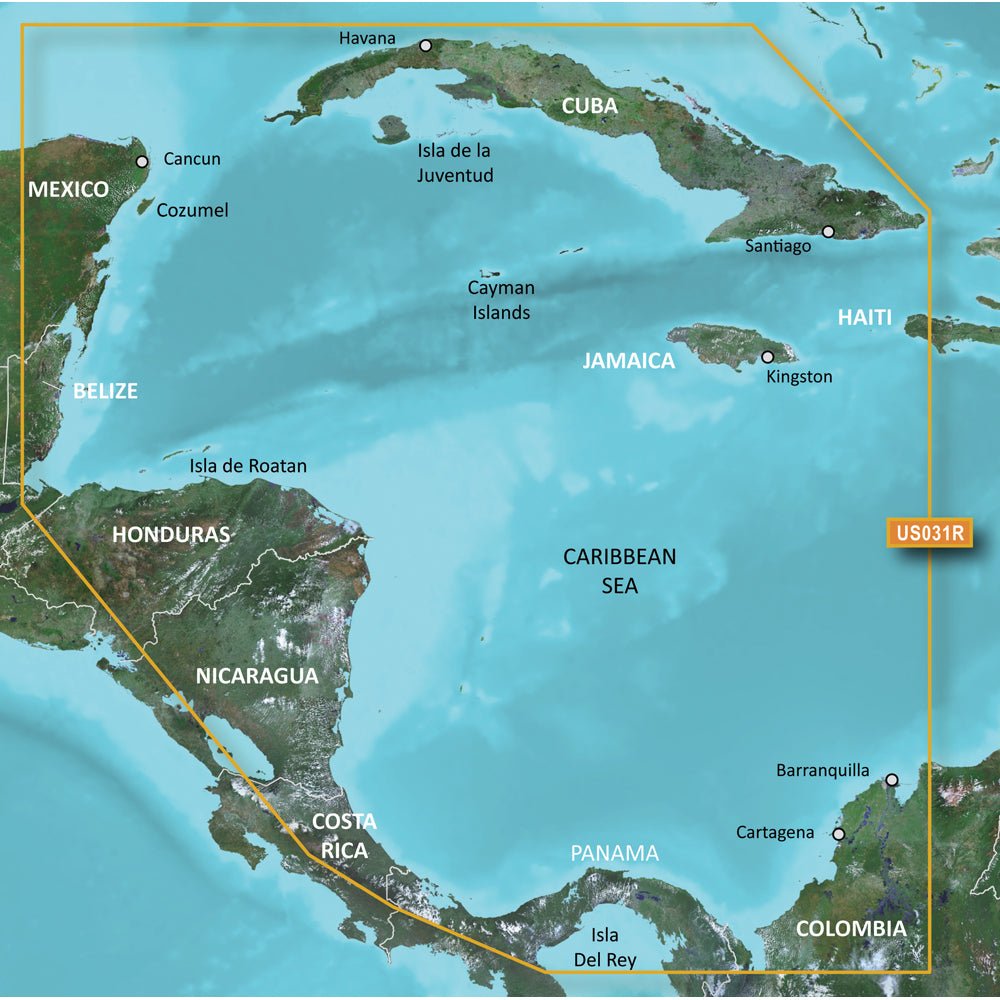
Garmin BlueChart g3 Vision HD - VUS031R for Southwest Caribbean on microSD/SD delivers ultra-detailed coastal charts with integrated Garmin and Navionics data for confident Caribbean navigation. Designed for boaters who need precise shoreline detail, harbor planning, and immersive visualization from Cancun, Mexico to Barranquilla, Colombia.
-
Coverage: Southwest Caribbean from Cancun, Mexico to Barranquilla, Colombia, including Cuba, Jamaica, the Cayman Islands, Cozumel, San Andreas and Providencia, Lake Izabal and the Rio Dulce, the entire Panama Canal, and the northern Gulf of Panama.
-
Integrated data: Garmin and Navionics data combined for accurate charts at a glance.
-
Auto Guidance: Uses your target depth and overhead clearance to calculate a recommended route for safer planning.
-
Relief shading: High-resolution relief shading combines color and shadow to reveal bottom structure more clearly than contour lines alone.
-
Depth Range Shading: Displays up to 10 depth ranges to let you see target depth instantly, from shallow harbors to deep channels.
-
Contour detail: Up to 1’ contours for precise representation of bottom features, improving fishing charts and navigation in swamps, canals, and marinas.
-
Shallow water shading: Helps identify and avoid shallow zones to keep operations safe.
-
NOAA Raster Cartography: Option available as a free download via the ActiveCaptain app, offering a paper-chart look on compatible displays.
-
Imagery and 3-D views: High-resolution satellite imagery provides detailed views of ports, marinas, bridges, and navigational landmarks; MarinerEye and FishEye perspectives above and below the waterline enhance situational awareness.
-
Format: microSD/SD card version compatible with chartplotters supporting BlueChart g3 Vision HD data.
-
Assurance: Auto Guidance and advanced visualization are designed to aid planning and confidence, but they do not replace safe navigation practices.
-
Usage foundation: This chart bundle provides a precise foundation for planning coastal passages across the Southwest Caribbean, from harbors to open water.
-
Safety note: California Prop 65 Warning: This product can expose you to chemicals known to cause cancer, birth defects, or other reproductive harm. For more information, visit P65Warnings.ca.gov.
Expect crisp shoreline rendering, detailed depth and bottom features, and authoritative data layers from Garmin and Navionics that support safer decisions on the water. Auto Guidance supports route planning based on your target depth and overhead clearance, while high-resolution imagery and 3-D views offer intuitive understanding of ports, bridges, and channels.