Garmin BlueChart g3 Vision HD - VUS038R, New York to Chesapeake, is your premier coastal navigation chart on microSD/SD. This advanced chart set combines industry-leading coverage with crystal-clear detail, integrating Garmin and Navionics data for a superior view of the water ahead.
-
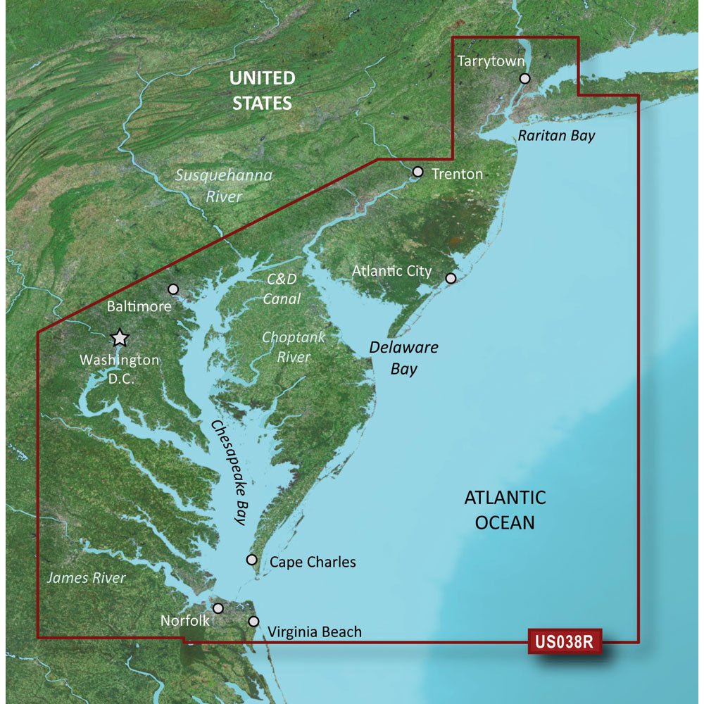
Extensive coastal coverage: Raritan Bay to Virginia Beach, including Tarrytown, Fire Island Inlet, the entire New Jersey coastline, the C&D Canal, Delaware Bay, the Delaware River to Trenton, Chesapeake Bay, Baltimore, the Potomac River to Washington D.C., Chincoteague Bay, Cape Charles, Newport News, and Norfolk.
-
Auto Guidance technology: Uses your desired depth and overhead clearance to calculate a routed path and provide a suggested course to follow.
-
High-resolution relief shading: Color and shadow combine to reveal bottom structure more clearly than contour lines alone.
-
Depth Range Shading: View up to 10 depth ranges, so you can spot target depths at a glance.
-
Contours up to 1 foot: Highly detailed bottom depiction for improved navigation in swamps, canals, and marinas and enhanced fishing charts.
-
NOAA Raster Cartography: Experience the look of paper charts with NOAA raster cartography, available as a free download via the ActiveCaptain app.
-
High-resolution satellite imagery: Detailed images of ports, marinas, bridges, and navigational landmarks for superior situational awareness.
-
Unique 3-D views: MarinerEye and FishEye perspectives provide additional context above and below the water line.
-
Integrated data: Industry-leading coverage with combined Garmin and Navionics data for reliable routing and rich detail on the water.
Notes: Auto Guidance is for planning purposes and does not replace safe navigation operations. NOAA raster cartography can be viewed via the ActiveCaptain app on compatible devices. This product may include a Prop 65 warning related to California regulations.