Garmin BlueChart g3 Vision HD - VUS515L is a premier coastal navigation solution designed for boaters who chart busy ports and expansive coastal passages along the Gulf of Mexico. This microSD/SD bundle combines rich detail with intelligent planning tools to help you navigate confidently.
-
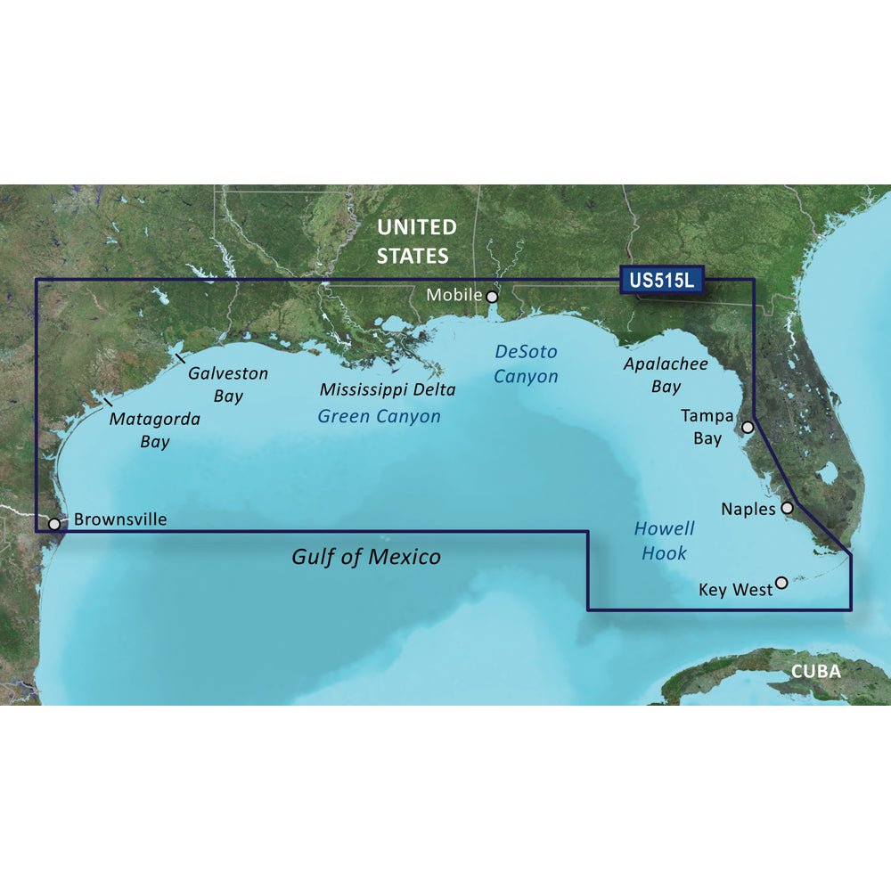
Comprehensive Gulf of Mexico Coverage: Detailed charts from Brownsville, TX to Plantation Key, FL, including Corpus Christi, Matagorda Bay, Galveston Bay, Port Arthur, Atchafalaya Bay, the Mississippi Delta, Chandeleur Islands, Tampa Bay, and the Florida Keys west of Key Largo; plus Lake Pontchartrain, Lake Maurepas up to Vermilion Bay and Lake Calcasieu.
-
Offshore Bathymetry: Precise depth data from Vernon Basin to Alaminos Canyon, including DeSoto Canyon, Mississippi Canyon, and Green Canyon for accurate bottom understanding.
-
Auto Guidance Routing: Uses your desired depth and overhead clearance to calculate a safe, practical route to follow.
-
High-Resolution Relief Shading: Color and shadow blending reveals bottom structure far more clearly than contour lines alone.
-
Up to 1’ Contours: Detailed depiction of bottom features for navigation in swamps, canals, and marinas.
-
Depth Range Shading: Displays up to 10 depth ranges at a glance for quick depth targeting.
-
NOAA Raster Cartography (ActiveCaptain): Offers a paper-chart look via the ActiveCaptain app (free downloadable feature).
-
Shallow Water Shading: Highlights shallow depths to help avoid hazards in tight waterways.
-
High-Resolution Satellite Imagery: Detailed views of ports, marinas, bridges, and navigational landmarks for enhanced situational awareness.
-
Unique 3-D Views: MarinerEye and FishEye perspectives provide additional viewpoints above and below the waterline.
-
MicroSD/SD Card Coverage: Ready-to-load format for compatible Garmin devices that support microSD/SD.
Whether docking in busy ports, charting coastal passages, or planning fishing trips, BlueChart g3 Vision HD delivers clarity, detail, and decision-ready tools to navigate with confidence and efficiency.