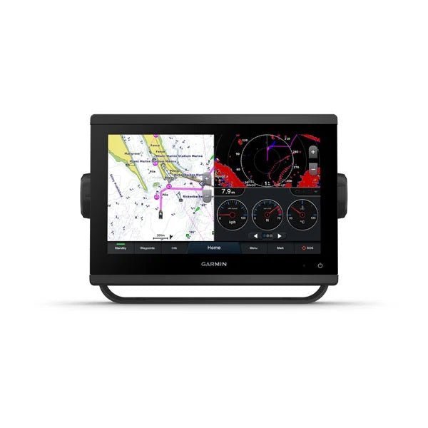
The Garmin GPSMAP923 9in Plotter is a central, connected helm plotter built for serious mariners who demand precise navigation and effortless control. With a bright 9-inch IPS touchscreen, worldwide basemap, and extensive Garmin connectivity, it helps you navigate confidently on every voyage.
-
Display & readability: 9.0" diagonal WXGA display (1280 x 720) with IPS edge-to-edge glass for sharp, easy viewing from across the cockpit; slimline form fits a wider range of dash configurations and remains readable in bright sunlight.
-
Performance & pixels: 50% more display pixels and nearly double the processing power of previous 9" GPSMAP models for faster map rendering and smoother interaction.
-
Maps & memory: Preloaded worldwide basemap; accepts 2 microSD cards (back of unit); 5,000 waypoints; 50,000 track points; 100 routes for comprehensive planning and logging.
-
Networking & data sharing: Share maps, user data, radar and IP camera video across compatible Garmin devices; connect to autopilots, digital switching, weather, Fusion‑Link audio, VHF, AIS, and more from a single interface; pair with OneChart, Garmin Helm digital switching, and Quickdraw Community data.
-
Navigation tools & sailing aids: Clear laylines, race start line guidance, enhanced wind rose, wind data fields, tide/current/time slider, wind angle, set and drift, wind speed to improve decision‑making on the water.
-
Premium charts & Auto Guidance: Optional premium Navionics charts and Auto Guidance technology for effortless routing and enhanced chart detail.
-
Compatibility & integration: Connects with quatix watches, gWind wireless transducers, GNX Wind instruments, and wireless remotes; compatible with select Yamaha engines for integrated control and monitoring.
-
Sonar & transducer options: Optional sonar/transducer capabilities; Panoptix PS51 (transducer sold separately) with FrontVü scanning sonar to 300 feet for real-time view of submerged structure and targets.
-
Hardware & durability: IPX7 water rating; power consumption up to 22 W (max); typical 1.3 A at 12 V; max 1.8 A at 12 V; internal or external antenna over NMEA 2000; 10 Hz high‑sensitivity receiver.
-
Mounting & installation: Flexible mounting options with bail, flush, or flat configurations to retrofit into a variety of helm layouts.
-
Marine network & ports: Garmin Marine Network port(s): 1, enabling expansion and connection with compatible devices across your cockpit.
-
Physical specifications: 9.2" x 6.4" x 3" (23.3 x 16.2 x 7.6 cm); 9.0" diagonal display; 3.6 lbs (1.6 kg); IPX7; Polarized support: Yes.
With a preloaded worldwide basemap and optional Navionics charts, you can plan voyages across oceans with confidence. The 9-inch IPS display delivers sharp, readable charts from the cockpit, while Garmin Marine Network and data sharing keep maps, radar, and IP camera video synchronized across devices. The system supports extensive waypoint and route storage (5,000 waypoints, 100 routes) and sailing aids like laylines, wind data fields, and tide/current views to enhance on‑water decision making. Optional Panoptix FrontVü sonar—paired with the PS51 transducer sold separately—offers real‑time view beneath the water up to 300 feet. Built to endure with IPX7 protection and efficient power usage, the GPSMAP923 provides flexible mounting and a streamlined helm experience, unifying navigation, charts, and sensor data in one reliable hub.
| General |
| PHYSICAL DIMENSIONS |
9.2" x 6.4" x 3" (23.3 x 16.2 x 7.6 cm) |
| DISPLAY SIZE |
7.8" x 4.4"; 9.0" diagonal |
| DISPLAY RESOLUTION |
1280 x 720 pixels |
| DISPLAY TYPE |
WXGA display |
| WEIGHT |
3.6 lbs (1.6 kg) |
| WATER RATING |
IPX7 |
| POLARIZED SUPPORT |
Yes |
| POWER CONSUMPTION |
Max power usage at 10 Vdc: 22 W
Typical current draw at 12 Vdc: 1.3 A
Max current draw at 12 Vdc: 1.8 A |
| ANTENNA |
Internal or external over NMEA 2000 |
| MOUNTING OPTIONS |
Bail, flush or flat |
| RECEIVER |
10 Hz high-sensitivity |
| GARMIN MARINE NETWORK™ PORTS |
1 |
| Maps & Memory |
| PRELOADED MAPS |
worldwide basemap |
| ACCEPTS DATA CARDS |
2 microSD™ cards (back of unit) |
| WAYPOINTS |
5,000 |
| TRACK LOG |
50,000 points; 50 saved tracks |
| ROUTES |
100 |
| Outdoor Recreation |
| TIDE TABLES |
Yes |
| Chartplotter Features |
| GARMIN RADAR COMPATIBLE |
Yes |
| GARMIN SONAR COMPATIBLE |
Yes (with external black box, sold separately) |
| GARMIN SMARTMODE COMPATIBLE (CUSTOMIZABLE MONITOR PRESETS) |
Yes |
| SUPPORTS AIS (TRACKS TARGET SHIPS POSITION) |
Yes |
| SUPPORTS DSC (DISPLAYS POSITION DATA FROM DSC-CAPABLE VHF RADIO) |
Yes |
| SUPPORTS FUSION-LINK™ COMPATIBLE RADIOS |
Yes |
| GSD™ BLACK BOX SONAR SUPPORT |
Yes |
| GCV™ BLACK BOX SONAR SUPPORT |
Yes |
| ACTIVECAPTAIN COMPATIBLE |
Yes |
| GRID™ (GARMIN REMOTE INPUT DEVICE) COMPATIBLE |
Yes |
| WIRELESS REMOTE COMPATIBLE |
Yes |
| SAILING FEATURES |
Yes |
| Sonar Features & Specifications |
| CHIRP SONAR TECHNOLOGY |
Yes (with external black box, sold separately) |
| CLEARVü |
Yes (with external black box, sold separately) |
| SIDEVü |
Yes (with external black box, sold separately) |
| Connections |
| NMEA 2000® COMPATIBLE |
Yes |
| NMEA 0183 INPUT PORTS |
1 (Differential) |
| NMEA 0183 OUTPUT PORTS |
1 (Differential) |
| VIDEO INPUT PORTS |
1 BNC |
| WIRELESS CONNECTIVITY |
Yes |
| J1939 COMPATIBLE |
Yes |