Garmin Navionics Vision+ NVSA011R South America (North) brings together the world’s leading marine cartography with Garmin chartplotters to deliver an all‑in‑one mapping solution for coastal, inland, and lake navigation. Featuring vibrant colors, a streamlined interface, and Navionics’ familiar style palette, this charting suite makes plotting courses easier and more precise than ever before.
What you get
- All‑in‑one map solution for Garmin chartplotters with combined Garmin and Navionics content for global coverage.
- One‑year subscription included with daily chart updates via the ActiveCaptain smart‑device app.
- Daily updates — up to 5,000 enhancements and amendments each day to keep charts current.
- MicroSD/SD format for easy installation and expansion on your device.
Coverage you can rely on
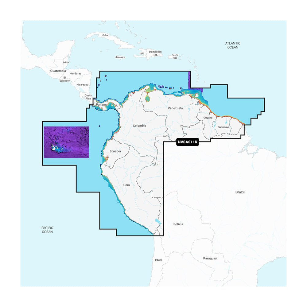
Detailed coverage of the entire coast of Panama, including the Panama Canal, plus coastal coverage for Peru, Ecuador, Colombia, Venezuela, Trinidad and Tobago, Guyana, Suriname, and French Guiana. This comprehensive mapping ensures you have the latest navigational data wherever your voyage takes you.
Key features that enhance navigation and fishing
-
Auto Guidance+ technology provides dock‑to‑dock routing suggestions, helping you navigate channels, inlets, and marina entrances with confidence.
-
Depth range shading lets you select up to 10 color‑shaded target depths for quick visual planning.
-
Up to 1′ contours deliver detailed bottom structure views for improved fishing and navigation in swamps, canals, harbors, and more.
-
Shallow water shading clearly highlights shallow areas to help you avoid hazards.
-
ActiveCaptain community provides user‑generated POIs, marina recommendations, hazards, and local insights from fellow boaters.
-
Premium features include High‑Resolution Relief Shading, High‑Resolution Satellite Imagery, and Aerial Photography for superior situational awareness.
-
3D Fisheye View offers an enhanced perspective of ports, docks, and navigational landmarks for easier situational assessment.
Why choose Navionics Vision+ for Garmin?
With an integrated Garmin/Navionics content base, you gain access to detailed coastal features, lakes, and rivers with regular daily updates. The visual richness, intuitive layers, and overlay options let you customize your map view to match your cruising or fishing plan—making every voyage easier, safer, and more enjoyable.
Upgrade your marine navigation with Navionics Vision+ Vision+ NVSA011R South America (North) and enjoy reliable, up‑to‑date charts, powerful routing, and premium imagery that put you in command on the water.