The Garmin NSUS006R Navionics+ U.S. South microSD provides an integrated Navionics+ mapping experience on Garmin chartplotters, featuring Navionics-style visuals, a refreshed color palette, and broad coverage across coastal waters, lakes, and rivers.
-
Integrated Garmin & Navionics+ content: Combines Garmin and Navionics+ data with an updated color palette for easy reading and navigation across U.S. South coverage.
-
Daily chart updates: Keep maps current on your device through the ActiveCaptain app.
-
Auto Guidance+ routing: Dock-to-dock route suggestions using depth, overhead clearance, chart data, and frequently traveled routes (planning purposes only and not a substitute for safe navigation).
-
NOAA raster cartography: Free downloadable imagery via ActiveCaptain, viewable on compatible devices.
-
Depth range shading: Up to 10 color options to quickly assess target depths at a glance.
-
1’ contour detail: Contours up to 1 foot provide detailed bottom structure for improved fishing and navigation.
-
Shallow water shading: Highlights depths up to a user-defined level for safer passage and prime fishing areas.
-
ActiveCaptain community content: POIs, recommendations, and local insights from boaters with firsthand experience.
-
Annual cartography updates: Renewable subscription (first year included) to keep charts up to date.
-
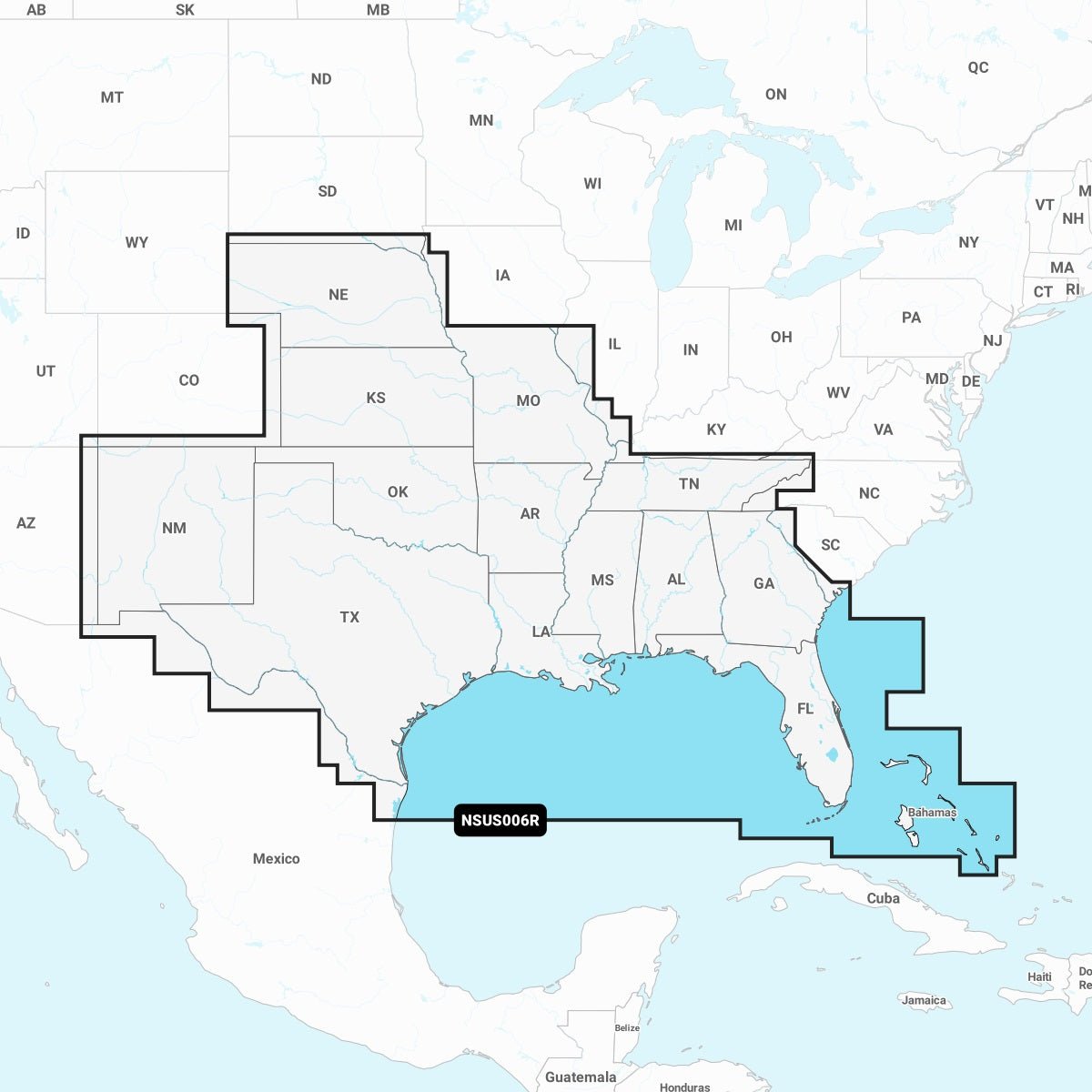
Extensive U.S. South coverage: Detailed mapping across Alabama, Arkansas, Florida, Georgia, Kansas, Louisiana, Mississippi, Missouri, Nebraska, New Mexico, Oklahoma, Tennessee, and Texas; Coastal Gulf of Mexico and Atlantic coasts of Florida and Georgia; the Bahamas and the Florida Keys.
The all-in-one Navionics+ experience on Garmin enhances planning and navigation by providing up-to-date data, advanced routing, and rich depth visuals. The first-year cartography updates are included, with an annual renewal option to keep charts current for coastal, inland, and open-water navigation.