Plot your paradise with the Garmin NVUS006R Navionics+ Vision+ U.S. South microSD—a premium marine cartography solution that blends Garmin reliability with Navionics Vision+ detail for coastal, inland, and offshore boating.
-
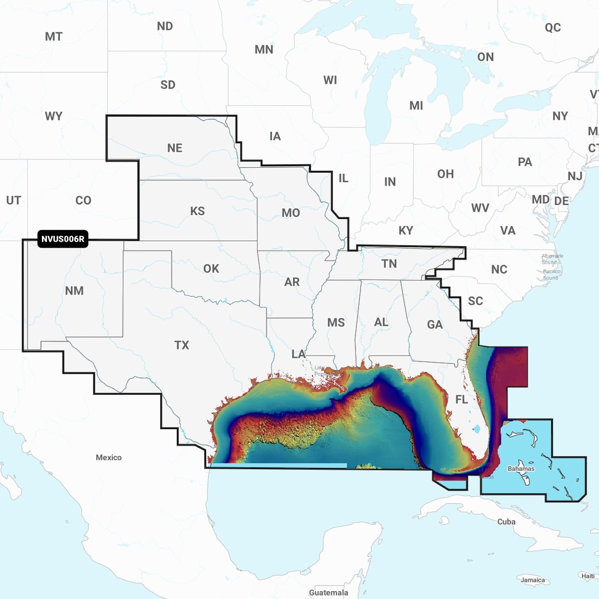
Premium U.S. South coverage: Exhaustive navigation data for Alabama, Arkansas, Florida, Georgia, Kansas, Louisiana, Mississippi, Missouri, Nebraska, New Mexico, Oklahoma, Tennessee, and Texas, plus extensive Gulf and Atlantic coastal regions, the Bahamas, and the Florida Keys.
-
Daily chart updates: Fresh data delivered via the ActiveCaptain® app; the first year of cartography updates is included and renewable annually.
-
High‑resolution relief shading: Color and shadow depth cues enhance bottom structure beyond contour lines for clearer seabed interpretation.
-
Auto Guidance+™ technology: Dock‑to‑dock path suggestions using depth, chart data, and frequent routes to aid planning (not a substitute for safe navigation).
-
High‑resolution satellite imagery: Realistic overlays that provide context to charts and help you spot landmarks and surroundings before entering unfamiliar harbors.
-
Aerial photography of ports and landmarks: Enhanced situational awareness above the waterline for ports, bridges, docks, and key features.
-
Side scan imagery: Reveals submerged features in select U.S. lakes—timber, fish attractors, wrecks, and hazards.
-
Sonar imagery: Color‑coded bottom hardness highlights transitions and structure on select U.S. lakes.
-
3D views: MarinerEye and FishEye: Additional perspectives above and below the water for easier interpretation of bottom contours and hazards.
-
NOAA raster cartography: Available as a free download via the ActiveCaptain app and viewable on mobile devices or compatible chartplotters.
-
Depth range shading: Up to 10 color options to quickly identify target depths at a glance.
-
Detail‑focused contours: Contours up to 1’ for precise bottom structure depiction and navigation planning.
-
Shallow water shading: Highlights depths up to user‑defined levels for safer coastal navigation.
-
ActiveCaptain® community content: POIs, recommendations, and local knowledge from boaters with firsthand experience.
-
What’s included: Cartography updates—annual renewable subscription with the first year included for continuous accuracy and refreshed data; coverage spans multiple states and coastal/inland areas for Gulf and Atlantic regions, the Bahamas, and the Florida Keys.
The Navionics Vision+ U.S. South microSD provides a trusted, data-rich foundation for planning trips, avoiding hazards, and navigating with confidence. With up‑to‑date charts, depth and seabed detail, and immersive visuals, you can anticipate tides, identify safe passages, and recognize landmarks before you enter unfamiliar harbors. The included first year of cartography updates ensures you start with current data, and renewal keeps your navigation information fresh year after year.