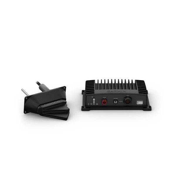
Garmin Panoptix LiveScope System With Thru-Hull delivers live, real-time underwater imaging that makes structure, bait, and fish around and beneath your boat easy to see—whether you’re moving or stopped. With LiveScope Forward, you can scout ahead up to 200 feet for smarter casting and on-the-water decision-making.
-
LiveScope real-time sonar: Live, interpretable images of what lies around and beneath your boat in real time, with the ability to track your lure on screen as you retrieve.
-
LiveScope Forward: Forward-looking scanning to scout and fish out ahead of your cast, up to 200'.
-
Broad, stabilized coverage: Up to 200 feet in every direction with a stabilized view that stays steady on your chartplotter screen in rough water thanks to Attitude Heading Reference System.
-
Plug-and-play Garmin Marine Network integration: Simple installation with a single Garmin Marine Network connection and seamless compatibility with a wide range of Garmin chartplotters.
-
Thru-hull LVS32 transducer with optional fairing block: Reliable thru-hull mounting for consistent performance; fairing block available for optimal hydrodynamics.
-
GLS 10 sonar black box and LVS32 transducer included: Core processing and sensing hardware packed with the transducer, mounting hardware, and essential cables for setup.
-
Supplemental traditional and ClearVü sonar: Historical representation of structure and fish below your boat in addition to real-time LiveScope images.
-
Wide compatibility: Works with Garmin chartplotters including GPSMAP 8400/8600, GPSMAP 7400/7600, 1002/1202, GPSMAP 1202/1202xsv Touch and 702/902 series, and ECHOMAP Plus 70cv/70sv and 90sv.
-
Technical specifications: Frequencies 530–1,100 kHz; Transmit power 500 W; Maximum forward depth 200' (61 m); Beamwidth 20° x 135°; Transducer cable length 20 ft; 21-pin transducer connectors; Power input 10–32 V; Power usage 21 W typical, 58 W max; IPX7 water rating; fuse 7.5 A.
-
What's in the box: GLS 10 sonar black box, Panoptix LVS32 transducer, thru-hull mount hardware, power cable, 2 m Garmin Marine Network cable (small connector), network adapter cable, mounting hardware, and documentation.
This system provides actionable, real-time insight into underwater life, helping you quickly identify structure and schools, track lures, and optimize your presentation in any water condition. Forward scanning extends your awareness to targets ahead of you, while the traditional and ClearVü sonar add context and history to what you see below. The rugged, IPX7-rated hardware is designed for demanding marine use, and the easy Garmin Marine Network setup keeps installation straightforward across a broad range of compatible chartplotters.
| Physical dimensions |
| GLS 10 sonar black box |
9.6" x 5.9" x 2.6" (24.5 x 14.9 x 6.5 cm) |
| LVS32-TH transducer without fairing block |
9.6" x 1.8" x 5.4" (24.4 x 4.6 x 13.7 cm) |
| LVS32-TH transducer with fairing block |
9.6" x 3.4" x 8.1" (24.4 x 8.6 x 20.6 cm)LVS32-TH transducer with fairing block: 9.6" x 3.4" x 8.1" (24.4 x 8.6 x 20.6 cm) |
| General |
| Water rating |
IPX7 |
| Garmin Marine Network™ ports |
1 (small connector) |
| Temperature range |
-15 C to 70 C |
| Sonar Features & Specifications |
| Frequencies supported |
530 - 1,100 kHz |
| Transmit power |
500 W |
| Maximum depth |
Forward: 200’ (61.0 m) |
| Electrical |
| Power input |
10-32 V |
| Power usage |
21 W typical, 58 W max |
| Fuse |
7.5 A |
| Other |
| Beamwidth |
20° x 135° |
| Transducer cable length |
20 ft. |
| Transducer number of pins |
21 |